MARITIME SPATIAL PLANNING

Managing competing ocean uses and activities to promote the health of our ecosystem and sustainable blue development 

Realising the potential of our ocean

Maritime spatial planning (MSP) is an effective instrument to sustainably manage our ocean resources. MSP enables us to harness the vast potential of the ocean and create benefits for society. As a comprehensive approach to resource management, MSP integrates stakeholders and scientific knowledge from marine conservation, climate change, and regional development into the planning and decision-making process on how we use our ocean.


SUBMARINER has been a leading force in supporting and enhancing the ongoing MSP efforts through strengthening the capacity of MSP stakeholders and decision makers, advocating for MSP to include Marine Protected Areas (MPAs) and innovative approaches and solutions such as aquaculture and multi-use in its frameworks. To date, Maritime Spatial Plans have been implemented by almost all coastal EU member states.

Discover our MSP projects

Our projects support the integration of innovative ocean uses within MSP by facilitating stakeholder engagement and promoting knowledge exchange

Adapting MSP to be ready for the future

Although maritime spatial planning has been implemented in most EU Member States, there are still several challenges that need to be addressed. These include improving monitoring and revision processes, enhancing the integration of climate change and marine protection into the planning frameworks, and finding ways to ensure that MSP remains adaptable to incorporate new concepts like ocean multi-use and emerging innovative activities such as artificial islands, offshore terminals, new types of aquaculture, renewables, and transnational hybrid interconnections. 

MSP resources hub

Our specialists have put together a collection of publications, additional relevant projects, tools, and resources on the topic of maritime spatial planning

13
Guidance for Building Climate Change Scenarios for Protection Strategies
Discover how new guidelines are helping Marine Protected Areas adapt to climate change. This essential framework aids MPA managers in assessing vulnerabilities and prioritizing strategies for effective,...
14
State of the Art on Key Barriers and Levels for Policy Coherence: Marine Policies in the EU Region
Explore the recent findings on the challenges and opportunities for integrating biodiversity concerns into marine policies across the EU. The report sheds light on key barriers and levers, providing insights...
15
Report on Digital Maps
This document describes Deliverable 1.7 of the Baltic MUPPETS project, which focuses on digital maps. It outlines the workflow for the development of digital maps, including the definition of the modelling...
WIN@Sea
WIN@Sea
Renewable energy and improved marine environment go hand in hand
OLAMUR
OLAMUR
Offshore Low-Trophic Aquaculture in Multi-use Scenario Realisation in North and Baltic Seas
North Sea Farm 1
North Sea Farm 1
The world's first commercial-scale seaweed farm located between offshore wind turbines.
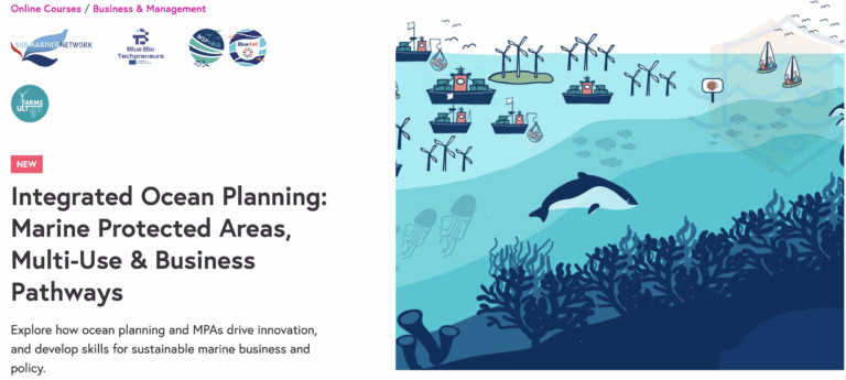
Ocean Multi Use Course
Beyond Offshore Wind: Ocean Multi-Use Course
First MOOC (massive online open course) on the topic of ocean multi-use!
MSP4BIO’s Data Compilation App Now Availabl
MSP4BIO’s Data Compilation App Now Available 
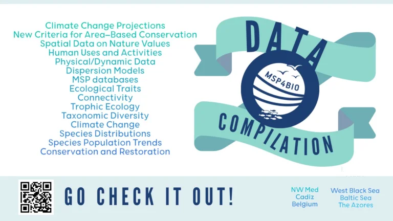
Access to good-quality ecological, environmental, and socio-economic data is essential for effective Maritime Spatial Planning (MSP) and the creation of Marine Protected Areas (MPAs).
Ocean Multi-Use Toolkit
The Ocean Multi-Use Toolkit is a comprehensive resource designed to support the integration of ocean multi-use (MU) within marine spatial planning (MSP) and associated policies

Latest MSP news

Still have questions? We have answers

Marine Spatial Planning is the ‘public process of analysing and allocating the spatial and temporal distribution of human activities to achieve ecological, economic and social objectives that are usually specified through a political process’. (Ehler and Douvere 2009)

In Europe, MSP is part of the overarching Integrated Maritime Policy of the EU which has, as its objective, to ‘support the sustainable development of seas and oceans and to develop coordinated, coherent and transparent decision-making in relation to the European Union’s sectoral policies affecting the oceans, seas, islands, coastal and outermost regions and maritime sector..’. (European MSP Platform)

The EU Directive on MSP defines MSP as: 

“a process by which the relevant Member State’s authorities analyse and organise human activities in marine areas to achieve ecological, economic and social objectives.” (EU MSP Directive)


More info: 

https://www.sustainable-projects.eu/publications-links

https://maritime-spatial-planning.ec.europa.eu/msp-eu/introduction-msp

An MSP process is expected to apply an “ecosystem-based approach (EBA).” This approach refers to ”a strategy for the integrated management of land, water and living resources including humans and their institutions in a way that promotes conservation and sustainable use in an equitable way”.

MSP is intended to inform the spatial distribution of maritime uses and activities in a sustainable manner that recognises and operationalises the following EBA elements (UNEP 2011):

1. aligning with ecosystem boundaries;

2. managing for multiple objectives/benefits;

3. considering cumulative impacts;

4. using best-available science and information;

5. applying the precautionary approach to deal with uncertainty; and

6. managing adaptively.


Read more: https://iwlearn.net/resolveuid/5c714161-b726-47a1-b4af-89e521d5f2db 

https://maritime-spatial-planning.ec.europa.eu/faq/ecosystem-based-approach

Different studies show that MSP needs to integrate better biodiversity at both policy and implementation levels, in particular in the light of recent adoption of the Kunming-Montreal Global Biodiversity Framework and EU biodiversity strategy for 2030. MSP4BIO project is addressing better biodiversity consideration in MSP, by developing an integrated flexible Ecological-Socio-Economic management framework and validating its concrete applicability in its 6 test sites in across the Europe. The project will build on the ongoing MSP and MPA processes at different scales from local, regional, national to sea basin level, and support effective management of future protected areas through improving and validating the criteria for MPA prioritization, integrating trade-off scenario analysis, improving the knowledge base for reviewing and evaluating existing maritime spatial plans, and providing recommendations on how to improve sectoral policies to better mainstream biodiversity considerations at EU/sea-basin/national level.

More information: SUBMARINER Network’s project – MSP4BIO

30×30 and 10×30 targets reference: European Commission, Directorate-General for Environment, EU biodiversity strategy for 2030 – Bringing nature back into our lives, Publications Office of the European Union, 2021, https://data.europa.eu/doi/10.2779/677548

Want to know more?

Reach out to our expert

Ivana Lukic, Multi-Use, MSP and MPA Team Lead

Email Ivana

Stay up to date on the latest developments in maritime spatial planning